
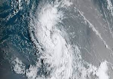
MIAMI, Sept 6, CMC – Tropical Storm Lee is churning its way towards the northern Leeward islands on Wednesday with a prediction that it could become the third hurricane of the 2023 Atlantic season later today.
The Miami-based National Hurricane Center (NHC) in its latest weather bulltin said that the storm is likely to “rapidly intensify into an extremely dangerous major hurricane by Saturday” and was located 1,200 miles, east of the northern Leeward Islands.
It has maximum sustained winds of 70 miles per hour (mph) and even though the NHC said that there are no coastal watches or warnings in effect, interests in the northern Leeward Islands should monitor the progress of this system.
“Lee is moving towards the west-northwest near 14 mph and this motion is
expected to continue for the next few days with a slight reduction in forward speed,” the NHC said, adding that continued steady to rapid strengthening is forecast, and Lee is expected to become a hurricane later today and a major hurricane in a couple of days and swells generated by Lee are expected to reach portions of the Lesser Antilles on Friday.
“These swells are likely to cause life-threatening surf and rip current conditionsm” the NHC added.
CMC/af/2023